Gem/Corona Mine: Death Valley NP
 We tend to think of National Parks as pristine places full of grand examples of Nature in all of its glory or architecture that once belonged to our Founding Fathers. Of course, the places that have been turned into those parks had long histories before they became part of the NPS system and some of them contain things that might surprise you. Death Valley NP is one of them.
You might know Death Valley as the broiling home to the lowest place in the continental US, but did you know that there are also multiple mountain ranges that rise over 11,000’? You may have heard of the 20 Mule Teams, but maybe not that they were hauling borax out of what later became Death Valley NP. It turns out that there were other mines in Death Valley. Lots of other mines. If you count only developed mines that were worked for an extended period there are upwards of 3000 mine sites in the park. If you also count pits that were
worked but played out quickly that count jumps into the tens of thousands and if you add mining claims it’s up around 100,000! The counts aren’t exact because unknown sites are still being found back in the corners and canyons of the biggest National Park in the lower 48.
Borax wasn’t the only thing that was mined in Death Valley. Gold and silver were also mined, along with copper, lead, zinc, salt…the list goes on. While some of the mines in Death Valley, like Skidoo, Harmony Borax and Keene Wonder Mine, became famous (if not necessarily prosperous) most of them are more or less unknown. The Gem mine was one of those.

On the eastern flanks of the Panamint valley, up a truck destroying ‘road’ of boulders, there is a small slot with a persistent stream running through it, named Jail Canyon. It was home to the Gem mine. The Gem was first worked in 1899 by a miner named Jack Curran. He dug and processed ore with his 3 stamp mill for only 2 years before his works were washed away in a flood. The site was opened again in 1930 with a 25 ton mill, jaw crusher, ball mill, elevator bin, rake classifier, flotation unit and a 50 horsepower diesel engine to power the process with drive shafts, wheels and canvas belts. A timber structure was built to carry the drive train next to the 30’ timber head frame that pulled ore out of a 260’ shaft. That incarnation went bust in 1938. In the 1940’s a guy named A.F. Troster gave it another go, sinking a few more shafts with no more luck than those who had tried before him, so he sold out to the Corona Mining Company in 1949. They only lasted for a few years before they too gave up. Troster came back and continued to work and live in Jail canyon into the mid 50’s.
The Gem mine site is still there. The power frame with it’s big wheels, shafts and even some canvas belts still exist along with the head frame, ore cribs and a few outbuildings. As you might imagine they are a little worse for the wear. Being an example of the mining technology of the early 1900’s, as well as historic structures, the NPS would like to keep them from falling over. To that end they called in Doug Porter, an architectural conservator to see if there was a way to stabilize what is left. Doug has done other timber stabilization projects in the park including on the aerial tramway at the Keene Wonder Mine.
The first step in figuring out how to save the structures is to do a condition assessment, but in order to keep track of what is deteriorated and what is still solid, Doug needed a set of drawings. As you can see from the interactive model, the site is complicated. It would be extremely challenging to measure and draw by hand, so Doug called Southwest Scanning to see if I would be interested in laser scanning the site and creating as-built drawings of the timber structures from the scans. Along with the drawings that Doug needed, the NPS was interested in documenting the machinery and other artifacts on the site.


Laser scanning, or LiDAR is the perfect way to do this kind of documentation, since it takes millions of 3 dimensional measurements of all of the surfaces and allows you to bring the resultant point cloud model into CAD, cut sections and draw from the model. The drawings above were some of what was produced for the project.
While LiDAR point clouds give you very accurate measurements that are great for doing drawings and look pretty realistic, they aren’t quite photographic. To capture the artifacts in a more realistic way I decided to use photogrammetry to create another 3 dimensional model of the site to help with my visualization of the site while I was working on the project. With photogrammetry you get an accurate and measurable model, but the real benefit is in the realism and detail that you get.
Doug and I spent 3 days in the park working on the site. I took 100 laser scans and then 500 photographs with a high resolution camera mounted on a 15’ monopod to allow me to get imagery of some of the higher parts of the frames. The interactive model above was built from the photographs.
Acequia Canova

In the high deserts of New Mexico, if you want to grow crops, you need to irrigate, so when the Spanish started settling in the Rio Grande valley they began building irrigation systems, or acequias. These acequias are one of the corner stones of the local culture and are still in use. The acequias pull water from a creek or river and contour along the hillsides above the waterway so that water can be delivered to the fields. When the acequia comes to a side canyon it either keeps contouring, or it has to cross the canyon. All sorts of flumes and pipes are used for these crossings. On the High Road to Taos, near the village of Trampas is this notable flume, or canova, made from large hollowed out logs.
.
Little Ivy Chapel
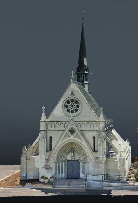
Built in 1890 in Denver Colorado’s Fairmount Cemetery, the Little Ivy Chapel is designated an historic landmark by the city.
.


First Christian Church, Trinidad, CO

Trinidad Colorado, close to the New Mexico border and along the route of the Santa Fe trail, was built on the wealth provided by the discovery of coal in the Raton Basin. It was founded in the 1860’s and solidified by the arrival of the Atchison, Topeka and Santa Fe Railway in 1878. During the years of the coal boom architecture thrived and many beautiful buildings were put up. One of these is the First Christian Church. It was designed by the firm of Rapp, Rapp & Hendrickson and built in 1922. It was added to the National Register of Historic Places in 1995.


Waldo Coke Kilns

In the late 1800’s there were 2 active coal mines in Madrid, NM (30 miles south of Santa Fe). In 1891 the mines were taken over by the Atchison Topeka & Santa Fe railroad which was able to improve the operations, open a third mine and put them on a solid economic footing. The railroad sold the operation to the Colorado Fuel & Iron Co in 1899.
If you’ve ever been to Madrid, you might think that it was always a pretty unassuming place, since the surviving structures are mostly small miners cabins. When the mines were operational however, there were some pretty substantial structures there, including a 300′ long and 137′ high ‘breaker’ which crushed and sorted the coal before it was shipped out on the Cerrillos Coal Railroad.
The Cerrillos Coal Railroad ran 4 miles north to where it met the AT&SF in Waldo, NM. At the time Waldo was home to about 100 people as well as 50 beehive coke kilns in two rows. The kilns were used to cook down a portion of the product from the Madrid mines into coke. They remained in operation into the mid 1950’s when the mines closed.
After operations ceased the stones from the front facade of the kilns was salvaged, and by some accounts, used to build a car dealership in Madrid. Today not much remains except for the stone wall that separated the two rows of beehive kilns and a small amount of the beehives themselves.

Our Lady of Light Community Center
Lamy, NM

The Our Lady of Light mission church in Lamy, NM was built in the mid 1920s as a replacement to an earlier incarnation. By the 1990s it had lost enough parishioners that the Catholic Archdiocese of Santa Fe decided to deconsecrate it. At that point the building had fallen on hard times and needed significant repairs. To enable that, a group of locals in Lamy created a 501 c3 non-profit organization and with substantial volunteer input replaced the roof , giving a new lease on life to this beautiful historic structure. Unfortunately, the roof wasn’t the end of the structural issues.
The Our Lady of Light Historic Foundation is currently working to raise a considerable amount of money to deal with issues with the foundation of the building, leaning walls and plaster issues.
The building is now used as a community center and hosts occasional events.
Rio Grande Food Project Community Garden

The Rio Grande Food Project (RGFP) is a food pantry, urban garden and community hub on the west side of Albuquerque. In spring of 2019, their small garden consisted of a few tomato and pepper plants, and many goat heads and tumbleweeds. The new urban garden plan consisted of building 20 raised beds, installing a decorative fence and erecting a pavilion for people to gather and enjoy the garden.
3 years later, the garden grows over 21 varieties of fruits and vegetables including grapes, strawberries, asparagus and potatoes! This fresh produce is weighed and immediately distributed to the people who visit RGFP for food assistance. Over 500 lbs of food was harvested in 2020-2021. The RGFP Urban Garden serves as a welcoming community space as well as a learning garden where people can discover important facts about the nutritional content of the food that is growing, as well as how to grow food at home or in an apartment.
Rio Grande Food Project believes that everyone deserves enough quality food, and along with providing food assistance, the RGFP Community Hub connects people to partner resources and services that maximize household incomes. This model works to reduce hunger on many levels, helping people with short and long-term solutions to the devastating effects of hunger.
For more information about Rio Grande Food Project, visit http://www.rgfp.org
Below is a video visualization of the design of a new addition to the garden. It was created by bringing the 3D photogrammetry model into CAD, modeling in new planters and virtually populating the model with plants and people.
Southwest Scanning has been donating their time and expertise to help the Rio Grande Food Project document this ongoing project.
Earthship

This model is an example of an earthship: a style of construction peculiar to the western US. Built from tires filled with rammed earth and cans stacked to create walls, earthships are built into hillsides and face south to collect solar thermal gain. On one side of the model you can see an open wall that shows examples of both types of construction exposed.
Historic Zinc Plant

This model is the abandoned American Zinc manufacturing facility near Dumas, TX. Originally opened in the early 1930’s, it was abandoned in the late 1960’s.
This project was built to show differences in resolution when flown with a 45 mp camera at different altitudes. The live model was flown at 300′.
For comparison, four photogrammetry models were created. Orthophotos were extracted from the 200′, 300′ and 400′ flights. These 3 orthophotos all exceed the resolution of a webpage. For examples of each resolution contact Southwest Scanning
Historic Borax Mine

Having worked on a number of early 20th century mine structures in the western US, I am continually amazed by the ingenuity and sheer toughness of the people who made their way to what are still remote areas, with dreams of striking it rich in some very inhospitable places. When you spend time working on the structures that they left behind (often camping on site because it’s too far to commute to), you can find yourself standing there at the end of the day shaking your head and wondering how the heck they got the materials there in the first place and then what it took to put them together into a system that would help someone wring money out of such an improbable scheme.
The Upper Biddy Skip Track is one of these structures. Originally built by the Pacific Coast Borax Company in 1914, the borax mine operated for only 13 years before other richer and easier to access deposits were discovered and the mine site was converted to a tourist hotel for a brief time. In 2013 the land and it’s structures were donated to an organization with a mission to preserve and restore the existing structures for study and teaching. The site is private and not open to the general public.
Several years ago the organization had the site laser scanned for documentation purposes. As it turned out that was a very good decision since a section of the skip track was subsequently blown down in a wind storm. They are currently working on a plan to stand the downed structures up again. As part of that project Southwest scanning has been asked to create 3 dimensional shop drawings from the point cloud data that was created by the laser scanning. The drawings will be used by the preservation crew to document the condition of the remaining timber as well as source new, in-kind replacement material.
This 3D model is a mesh created from the point cloud data that will help in visualizing the site during the drawing phase.
Wilderness Gate

This is a photogrammetry model of a residential project in Santa Fe, NM. The builder, who is working on a remodel of the house, wanted to have an orthophoto site plan of the property so that they could see all of the HVAC work, cables and conduit on the roof. The 3D model will also help the builder to plan for access during construction. This project was also laser scanned and as-built drawings were produced from those scans by Southwest Scanning.


Old Stone Foundation

This is an interesting archaeological site on the southern tip of the Sangre de Christo mountains in northern New Mexico. It looks to be the ruins of a small stone structure who’s walls have come down. On the 2 flat stones on the floor are 4 artifacts. Three stone axe heads or hammers and a small bowl of some sort. These were found in the structure years ago, but could have been put there by someone other than the person who used them.
This high resolution 3D photogrammetric model was created from 42mp terrestrial photos shot on a tall monopod and from the ground.

John Coltrane’s Grave

In 2020 I was in NY and found myself with some free time. Being a jazz fan I knew that John Coltrane was buried not far from where I was, so I looked up the location of his grave and took a drive with my brother in law.
Pinelawn Memorial Park is a beautiful cemetery. When I told the folks who worked there that I was looking for Trane’s grave they mentioned that Count Basie and Freddie Green were also buried there. We spent a lovely afternoon wandering around and since I had my phone with me I thought that it would be fun to take some pictures and put together a quick photogrammetry model.