Laser Scanning
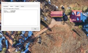
 Laser scanning uses LiDAR (light detection and ranging) technology to capture three dimensional measurements of structures and create digital models that can serve as the basis for 2 dimensional drawings, be imported directly into 3D modeling software for additional design work or be used for digital documentation.